![Trail Quad Area A (Hudson Bay Mountain) - Wikiloc - The Microwave - Photo](https://media.geolcdn.com/t/1900/400/ext.pjpeg?maxdim=2&url=https%3A%2F%2Fstatic1.geolcdn.com%2Fsiteimages%2Fupload%2Ffiles%2F15247431544x4.jpg)
Wikiloc - The Microwave
Alizée.pee
User GUIDE
![Length](/images/other/stat-length.png)
Length
50 km
![Max alt](https://static1.geolcdn.com/siteimages/upload/files/1508320355ic_sort_altitude_max_24dp.png)
Max alt
1850 m
![Uphill gradient](https://static1.geolcdn.com/siteimages/upload/files/1508320355ic_sort_den_pos_24dp.png)
Uphill gradient
1520 m
![Km-Effort](/images/other/stat-length.png)
Km-Effort
71 km
![Min alt](https://static1.geolcdn.com/siteimages/upload/files/1508320355ic_sort_altitude_min_24dp.png)
Min alt
692 m
![Downhill gradient](https://static1.geolcdn.com/siteimages/upload/files/1508320355ic_sort_den_neg_24dp.png)
Downhill gradient
1519 m
![Boucle](https://static1.geolcdn.com/siteimages/upload/files/16400158638029165_repeat_loop_refresh_sync_direction_icon.png)
Boucle
Yes
Creation date :
2019-08-26 13:41:20.336
Updated on :
2019-08-26 13:43:53.644
![Quad](https://static1.geolcdn.com/sitytour/trail-icons/404.png)
3h30
Difficulty : Medium
![Scan this QR Code to open this trail in the SityTrail application](https://capi.geolives.com/qq0zvz2zws4bq2lad0pu/sitytour/trails/2183657/qr.png?size=200)
FREE GPS app for hiking
About
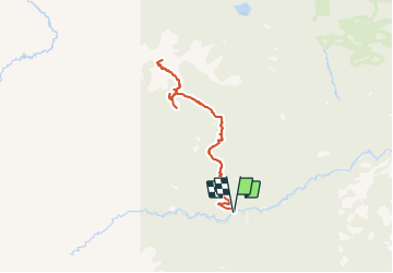
Trail Quad of 50 km to be discovered at British Columbia, Regional District of Bulkley-Nechako, Area A (Hudson Bay Mountain). This trail is proposed by Alizée.pee.
Description
Cette randonnée vous mène jusqu'au sommet de "The Microwave". Il y a de magnifiques paysages allant de la neige, vallées, végétations, lac ainsi que de splendides montagnes.
Positioning
Country:
Canada
Region :
British Columbia
Department/Province :
Regional District of Bulkley-Nechako
Municipality :
Area A (Hudson Bay Mountain)
Location:
Unknown
Start:(Dec)
Start:(UTM)
604523 ; 6052234 (9U) N.
Comments
Trails nearby